How was the planning application for a fire station at Saughall Massie (APP/16/00985) introduced to Wirral Council’s Planning Committee (part 1)?

How was the planning application for a fire station at Saughall Massie (APP/16/00985) introduced to Wirral Council’s Planning Committee (part 1)?

How was the planning application for a fire station at Saughall Massie (APP/16/00985) introduced to Wirral Council’s Planning Committee (part 1)?


Please accept YouTube cookies to play this video. By accepting you will be accessing content from YouTube, a service provided by an external third party.

YouTube privacy policy

If you accept this notice, your choice will be saved and the page will refresh.

Wirral Council’s Planning Committee 19th December 2016 starting at agenda item 6 ( APP/16/00985: Land adjacent to Saughall Massie Road, Saughall Massie, Wirral)

Over a hundred people were in the Civic Hall for a public meeting of Wirral Council’s Planning Committee held last week at Wallasey Town Hall to hear what the Planning Committee would decide on planning application APP/16/00985. This planning application was for a single storey two bay community fire station with accommodation, offices, meeting space, external drill, training facilities and car parking on land adjacent to Saughall Massie Road in Saughall Massie.

The applicant was Merseyside Fire & Rescue Service.

A 21 page report on the planning application by Wirral Council planning officers recommended that the Planning Committee approve the application subject to referral to the government minister.

Councillor Anita Leech (Chair, Wirral Council's Planning Committee) 15th December 2016 planning application APP/16/00985
Councillor Anita Leech (Chair, Wirral Council’s Planning Committee) 15th December 2016 planning application APP/16/00985

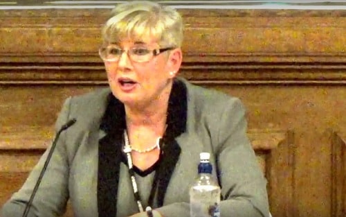
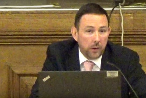
After the Chair of the Planning Committee Cllr Anita Leech (pictured above) introduced the item, Matthew Parry-Davies (a manager from Wirral Council’s Planning Department pictured below) explained that the planning application had been subject to a site visit by councillors on the Planning Committee two days earlier (as reported on and filmed by this blog).

Matthew Parry-Davies (Wirral Council) Planning Committee 15th December 2016 planning application APP/16/00985
Matthew Parry-Davies (Service Manager (Development Management), Wirral Council) Planning Committee 15th December 2016 planning application APP/16/00985

Planning permission was sought for a single storey two bay community fire station, together with operational and welfare accommodation, offices and meeting space, external drill and training facilities and associated car parking.

Continuing, he said that the site was in the green belt and as such the development applied for constituted, “inappropriate development”. Having regard to national planning policies and Wirral’s Unitary Development Plan and policy GB2 which set out guidelines for development in the green belt, such inappropriate development should be refused unless “very special circumstances” had been put forward that would outweigh any potential harm to the openness and character of the green belt.

Mr Parry-Davies explained that there were not a national or local definitions of what constituted “very special circumstances” and as such each [planning] application needed to be judged on its individual merits.

Referring to the applicant’s case, he stated that the need for a new fire station in this greenbelt location centred on the unavailability of suitable alternative locations outside of the green belt and the need to provide the best achievable emergency response to west Wirral locations.

Mr Parry-Davies said that Merseyside Fire and Rescue Authority were rationalising their property portfolio of operational fire stations arising from cost efficiencies which resulted in the closure of fire stations. As a result of this either West Kirby Fire Station or Upton Fire Station would have to close as a result of budget cuts, with Upton Fire Station remaining crewed because it covered a more extensive area.

It was the applicant’s case that the provision of a new fire station in this location to cover both the West Kirby and Upton coverage areas, would result in a reduction of response times to west Wirral by an average of two minutes.

He mentioned a link between response times and the level of damage to property, severity of injury and the likelihood of death. The quicker the Merseyside Fire and Rescue Service could respond, the less likely major damage, significant injury or fatalities would occur. Closing West Kirby Fire Station and Upton Fire Station and building a new fire station at this location, would result in faster than average response times which could mean the difference between the level of damage and/or the severity of injury or even death.

Mr Parry-Davies said that the new location would allow Merseyside Fire and Rescue Service to maintain acceptable response times and it was argued that this demonstrates very special circumstances that outweighed the potential harm to the greenbelt.

Commenting on the site, he said that the site was opposite residential properties on Saughall Massie Road to the north and Woodpecker Close to the east. The nearest residential properties were 281 Saughall Massie Road and numbers 68, 70 and 72 Woodpecker Close. Mr Parry-Davies wanted to spend a little time explaining the relationship between the proposal to the residential properties and he was putting a different plan up for councillors to see.

Referring to the appliance bay, he explained that the appliance bay was the part of the fire station where the fire engines would be housed. The operational bay was the other side of the proposal where the meeting rooms, sleeping accommodation, kitchens and those sorts of things would be.

So firstly, the properties that front on to Saughall Massie Road which were 286 to 296 Saughall Massie Road. These were thirty metres to forty metres from the site perimeter. 296 Saughall Massie Road was located fifty-five metres from the front of the operational and welfare part of the proposals and fifty-nine metres from the appliances bay which would house the fire engines.

These distances decreased slightly with 288 being fifty metres from the operational bay and fifty-seven metres from the appliances bay before increasing again as you move east along Saughall Massie Road.

The blank elevation of 281 Saughall Massie Road which was a bungalow was located thirteen metres at its closest point to the perimeter of the site and thirty metres to the operational bay. The appliances bay would be forty-five metres from that property but sits behind the operational bay.

Numbers 68, 70 and 72 Woodpecker Close would have their front elevations facing the site and they were bungalows. These properties were sheltered accommodation for elderly people. At its nearest point 68 Woodpecker Close is fourteen metres from the site boundary, number 70 is fifteen and a half metres and number 72 is seventeen metres from the boundary.

Number 68 Woodpecker Close is thirty-two metres from the operational bay, number 70 is thirty-four metres and number 72 is thirty-five metres away. The operational bay sits between those properties and the appliance bay, acting as a buffer for the appliance bay where the fire engines would be housed.

A sprinkler and generator compound, the area edged red on the plan is located in the southeast corner of the site, located twenty-five metres from the rear elevations of 47-51 Woodpecker Close. These properties were located over forty metres from any part of the proposed buildings.

The training yard was the yellow hatched area of the plan which would be located to the rear of the bays and would be over fifty metres from the nearest residential property. He pointed out a retractable training tower located at the southern part of the site. Training would typically be carried out at monthly intervals, during the working day without the use of sirens. The training tower would fold down when not in use to minimise its impact on the green belt.

A noise assessment had been submitted with the application, which had examined noise sensitive receptors including residential properties. Measures were proposed to minimise noise impact, although the fire station would be operational twenty-four hours a day, the yard would only be used when returning from an incident between the hours of 11 pm and 7 am and would only be used for operational and training purposes between 9 30 in the morning and 4 30 in the afternoon. Sirens would only be used at times when there was significant road traffic and at night restricted to calls where life was at risk. A number of conditions were proposed should the application be approved, to avoid and or minimise noise impacts.

In terms of highway movements and the impact on the safe use and flow of the highway, the development is likely to generate low levels of vehicle movements onto the adjacent network and are therefore unlikely to have significant impact on traffic conditions in the area.

The Saughall Massie Conservation Area boundary site thirty-five metres to the north-west. However given the use of materials proposed, existing vegetation providing screening and distances involved, it was not considered the proposals would adversely impact on the Saughall Massie Conservation Area.

Substantial weight must be given to any harm these proposals would have on the green belt by virtue of the permanent loss of openness and any visual harm that may result. Councillors on the Planning Committee must be satisfied that very special circumstances exist that outweighs any harm caused by inappropriate development. The reduced response times enabling Merseyside Fire and Rescue Service to attend emergencies in parts of west Wirral would be two minutes quicker on average and has led to a finely balanced recommendation of approval.

A number of measures proposed in terms of site layout, boundary treatment, together with planning conditions outlined in the report, serve to mitigate against any harm to residential amenity. On balance the application was recommended for approval and there was a qualifying petition of objection.

The Chair Cllr Anita Leech thanked Mr Parry-Davies for his presentation. As there was a qualifying petition of objection she asked if the lead petitioner would like to come forward?

Cllr Steve Williams (Moreton West and Saughall Massie) explained that the lead petitioner did not wish to speak.

The Chair thanked him for that and explained that as the lead petitioner hadn’t spoken, then the applicant wasn’t able to speak according to the constitution.

She asked if the ward councillor would like to come forward and speak and asked him to give his name before he started.

If you click on any of the buttons below, you’ll be doing me a favour by sharing this article with other people.

What’s in Merseyside Fire and Rescue Service’s planning application for a new fire station in Saughall Massie?

What’s in Merseyside Fire and Rescue Service’s planning application for a new fire station in Saughall Massie?

What’s in Merseyside Fire and Rescue Service’s planning application for a new fire station in Saughall Massie?


Dan Stephens (Chief Fire Officer) answers questions at a public consultation meeting in Saughall Massie to discuss proposals for a new fire station thumbnail
Dan Stephens (Chief Fire Officer) answers questions at a public consultation meeting in Saughall Massie to discuss proposals for a new fire station

The planning application for a new fire station in Saughall Massie has been made to Wirral Council by Merseyside Fire and Rescue Service.

The application number is APP/16/00985 and the description is, "A single storey two bay community fire station incorporating operational and welfare accommodation, offices and meeting space, external drill and training facilities and associated car-parking." at "land adjacent to SAUGHALL MASSIE ROAD, SAUGHALL MASSIE" .

The planning application form for this is 9 A4 pages long so I will summarise the details below. Further details are expected to be published on Wirral Council’s website in the near future.

You can make a comment supporting or objecting to this planning application on Wirral Council’s website which also contains the documents that are part of the planning application.

It is expected after a period of consultation with the public for the planning application to be decided by Wirral Council’s Planning Committee in October 2016.


1. Applicant Name, Address and Contact Details

Mr Colin Schofield
Merseyside Fire & Rescue Service
Merseyside FRS HQ
Bridle Road
Bootle
L30 4YD

2. Agent Name, Address and Contact Details

Mrs Dawn Coward
Ryder Architecture
Innovation Centre
131 Mount Pleasant
Liverpool
United Kingdom
L3 5TF

Tel: 0151 237 1300
Email: dcoward@ryderarchitecture.com

3. Description of the Proposal

A single storey two bay community fire station incorporating operational and welfare accommodation, offices and meeting space, external drill and training facilities and associated car-parking.

Has the building, work or change of use already started? No.

4. Site Address Details

Land of Saughall Massie Road
Saughall Massie
Upton
Wirral

Easting 325469
Northing 388515

5. Pre-application advice

Has assistance or prior advice been sought from the local authority about this application? Yes

Officer name:
Mrs Sheila Day
Department of Regeneration and Planning
04/11/2015

Details of the pre-application advice received:

Following request for pre-application advice and meetings with planning case officer and colleagues, a detailed response was received and covered the following:
– Advice on scale, massing and positioning of the building.
– Advice on landscaping
– Advice on highway interfaces and parking
– Review of ground investigation.
– Request for further particulars that justified the location of the fire station and evidence of community consultation
– Request for details of training procedures and frequency

6. Pedestrian and Vehicle Access, Roads and Rights of Way

Is a new or altered vehicle access proposed to or from the public highway? Yes

Is a new or altered pedestrian access proposed to or from the public highway? Yes

Are there any new public roads to be provided within the site? No

Are there any new public rights of way to be provided within or adjacent to the site? No

Do the proposals require any diversions/extinguishments and/or creation of rights of way? No

If you answered Yes to any of the above questions, please show details on your plan/drawings and state the reference of the plan(s)/drawings(s)

28042 – 691 – P2-A3.pdf
28042 – 692 – P2-A3.pdf
28042 – 693 – P2-A3.pdf
28042 – 615 – P2-A1 PLAN.PFG
J667 Saughall Massie Fire TS.pdf

7. Waste Storage and Collection

Do the plans incorporate areas to store and aid the collection of waste? Yes

If Yes, please provide details:
Enclosed bin store

Have arrangements been made for the separate storage and collection of recyclable waste? Yes

If Yes, please provide details:
Separate storage bins within bin store.

…..
9. Materials

Please state what materials (including type, colour and name) are to be used externally (if applicable):

Boundary Treatments – description:
Description of proposed materials and finishes:
Polyester powder coated mesh fencing, earth embankment retaining walls with soft landscaping treatment as appropriate.

Doors – description:
Description of proposed materials and finishes:
Polyester powder coated aluminium / steel

Lighting – description:
Description of proposed materials and finishes:
PPC steel / aluminium street lamps and aluminium bollards

Roof – description:
Description of proposed materials and finishes:
Aluminium standing seam cladding.

Vehicle Access – description:
Description of proposed materials and finishes:
Tarmacadam and concrete surfacing

Walls – description:
Description of proposed materials and finishes:
Aluminium standing seam cladding. Timber rain screen vertical cladding. Dark grey facing brickwork. PPC aluminium curtain walling in silver grey.

Windows – description:
Description of proposed materials and finishes:
Polyester powder coated aluminium

OTHER – description:
Description of proposed materials and finishes:
Polyester powder coated aluminium glazed overhead sectional doors

Are you supplying additional information on submitted plan(s)/drawing(s)/design and access statement? Yes

If Yes, please state references for the plan(s)/drawing(s)/design and access statement:

Design_and_access_statement_reduced_final.pdf
2864-01-MFRS_RYD-00-ZZ-DR-A-2000-S0-P2 – Location Plan.pdf
2864-01-MFRS-RYD-00-ZZ-DR-A-0001-S0-P1-Existing Site Information.pdf
2864-01-MFRS-RYD-00-ZZ-DR-A-2001-S1-P8-Site Plan.pdf
2864-01-MFRS-RYD-00-ZZ-DR-A-9001-D1-P3_Site Sketch Sections.pdf
2864-01-MFRS-RYD-00-00-DR-A-3001-S1-P6_Proposed GA Plan.pdf
2864-01-MFRS-RYD-00-R0-DR-A-3002-S1-P1_Proposed GA Roof Plan.pdf
2864-01-MFRS-RYD-00-ZZ-DR-A-3602-S1-P5-GA Elevations.pdf
2864-01-MFRS-RYD-00-ZZ-DR-A-3603-S1-P1-Training tower alternating position.pdf
2864-01-MFRS-RYD-00-ZZ-DR-A-3901-S1-P1_Typical Strip Section 01.pdf
2864-01-MFRS-RYD-00-ZZ-DR-A-3903-S1-P1_Typical Strip Section 03.pdf
2864-01-MFRS-RYD-00-ZZ-DR-A-3904-S0-P1_Typical Strip Section 04.pdf
2864-01-MFRS-RYD-00-ZZ-DR-A-3601-S0-P3_External Views.pdf
2864-01-MFRS-RYD-00-ZZ-DR-A-3801-S0-P1_GA Sectionss.pdf
Q10568-01.pdf
2864-01-MFRS-RYD-00-ZZ-VS-A-1402-S1-P1_CGI Street View Visualisation.pdf
3371.PR-03 Saughall Massie F&R Colour Landscape Layout.pdf
28042 – 615 – P2-A1 PLAN.PDF
Saughall Massie F&R General Arrangement Plan 3371_PR_01 rev A.pdf
Saughall Massie F&R Planting Plan 3371_PR_02 rev A.pdf
Saughall Massie F&R Tree Protection Plan_final_reduced.pdf
28042 Saughall Massie FRA rev 3 reduced.pdf
20662R01PKmdw.pdf
LG28042 – Phase I Preliminary Risk Assesment VrA SPLIT_Part1.pdf
LG28042 – Phase I Preliminary Risk Assesment VrA SPLIT_Part2.pdf
LG28042 – Phase I Preliminary Risk Assesment VrA SPLIT_Part3.pdf
28042 Drainage Assessment and Strategy REV 01.pdf
Leigh Ecology – Amphibian_Report – Merseyside Fire and Rescue Saughall Massie.pdf
Leigh Ecology – Ecological Appraisal – Merseyside Fire and Rescue Saughall Massie.pdf
28042 – 691 – P2-A3.pdf
28042 – 692 – P2-A3.pdf
28042 – 693 – P2-A3.pdf
70019-R-002 – Saughall Massie Fire Station – Travel Plan Framework_V2-2.pdf
70019-R-002 – Saughall Massie Fire Stn – TPF Appendices_V2-2.pdf
J667 Saughall Massie Fire TS.pdf
SM Heritage Statement February 16_reduced.pdf
2864_01_Statement of Community Involvement_FinalCombined.pdf
2864_01_Ryder Planning Statement – Very Special Circumstances FINAL 20160715

10. Vehicle Parking

Total proposed (including spaces retained)

Cars 11
Cycle spaces 12
Disability spaces 2
Motorcycles 4
Other (e.g. bus) 2

Short description of Other Fire appliances (note: within appliance bay)

11. Foul Sewage

Please state how foul sewage is to be disposed of:

Mains sewer

Are you proposing to connect to the existing drainage system? Yes

If Yes, please include the details of the existing system on the application drawings and state references for the plan(s)/drawing(s):
28042 Drainage Assessment and Strategy REV 01.pdf

12. Assessment of Flood Risk

Is the site within an area at risk of flooding? No

Is your proposal within 20 metres of a watercourse (e.g. river, stream or beck)? No

Will the proposal increase the flood risk elsewhere? No.

How will surface water be disposed of? Sustainable drainage system Main sewer

13. Biodiversity and Geological Conservation

Is there a reasonable likelihood of the following being affected adversely or conserved and enhanced within the application site, OR on land to or near the application site:

a) Protected and priority species
No

b) Designated sites, important habitats or other biodiversity features
No

c) Features of geological conservation importance
Yes, on land adjacent to or near the proposed development

14. Existing Use

Please describe the current use of the site:
Vacant land

Is the site current vacant? Yes

If Yes, please describe the last use of the site: Vacant grass land

Does the proposal involve any of the following? If yes , you will need to submit an appropriate contamination assessment with your application.

Land which is known to be contaminated? No

Land where contamination is suspected for all or part of the site? No

A proposed use that would be particularly vulnerable to the presence of contamination? No

15. Trees and Hedges

Are there any trees or hedges on the proposed development site? Yes

And/or: Are there trees or hedges on land adjacent to the proposed development site that could influence the development or might be important as part of the local landscape character? Yes

If Yes to either or both of the above, you may need to provide a full Tree Survey, at the discretion of your local planning authority. If a Tree Survey is required, this and the accompanying plan should be submitted alongside your application. Your local planning authority should make clear on its website what the survey should contain, in accordance with the current ‘BS5837: Trees in relation to design, demolition and construction – Recommendations’.

16. Trade Effluent

Does the proposal involve the need to dispose of trade effluents or waste? No

17. Residential Units

Does your proposal include the gain or loss of residential units? No

18. All Types of Development: Non-residential Floorspace

Does your proposal involve the loss, gain or change of use of non-residential floorspace? Yes

Total gross new internal floorspace proposed (including changes of use) (square metres) 737
Use Class/type of use: Other

19. Employment

If known, please complete the following information regarding employees:

Proposed employees 10 (full-time)

20. Hours of Opening

No Hours of Opening details were submitted for this application

21. Site Area

What is the site area? 4,950.00 sq. metres

22. Industrial or Commercial Processes and Machinery

Please describe the activities and processes which would be carried out on the site and the end products including paint, ventilation or air conditioning. Please include the type of machinery which may be installed on site:

Compressors for refilling and testing of breathing apparatus.
Hydraulic cutting devices for car cutting during road traffic collision simulation.

Is the proposal for a waste management development? No

23. Hazardous Substances

Is any hazardous waste involved in the proposal? No

24. Site Visit

Can the site be seen from a public road, public footpath, bridleway or other public land? Yes

If the planning authority needs to make an appointment to carry out a site visit, whom should they contact? (Please select only one)

The agent

25. Certificates (Certificate B)

Certificate of Ownership – Certificate B
Town and Country Planning (Development Management Procedure) (England) Order 2015 Certificate under Article 14
I certify/ The applicant certifies that I have/the applicant has given the requisite notice to everyone else (as listed below) who, on the day 21 days before the date of this application, was the owner (owner is a person with a freehold interest or leasehold interest with at least 7 years left to run) and/or agricultural tenant (“agricultural tenant” has the meaning given in section 65(8) of the Town and Country Planning Act 1990) of any part of the land or building to which this application relates.

Owner/Agricultural Tenant
Wirral Metropolitan Council
Brighton Street
Wallasey
CH44 8ED

15/7/2016

Mrs Dawn Coward
AGENT
15/7/2016

26. Declaration

I/we hereby apply for planning permission/consent as described in this form and the accompanying plans/drawings and additional information. I/we confirm that, to the best of my/our knowledge, any facts stated are true and accurate and any opinions given are the genuine opinions of the person(s) giving them.

15/7/2016


If you click on any of the buttons below, you’ll be doing me a favour by sharing this article with other people.