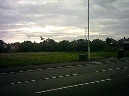
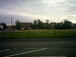
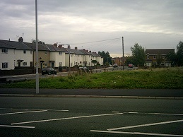
Tollemache Road greenfield or 12 houses? Planning Committee decides tonight
You can click on the photos above for more detailed versions. Earlier this year in a similar case, despite Cllr Ian Lewis’s best efforts, the Planning Committee voted 7 votes to 6 against local resident’s wishes to approve building a play area on some greenspace in Leasowe.
This planning application is for building a dozen houses on this field. The officer’s report to the Planning Committee recommends refusal as they believe it to conflict with policies HS4, GR6, CS42, CS6, CS32 and the National Planning Policy Framework. Normally such an application would be decided by officers. However Cllr George Davies (the Cabinet Member for Neighbourhoods, Housing and Engagement) has taken it out of their hands and asked for the Planning Committee to decide it instead as Cllr George Davies thinks that the proposed development would “help to address identified housing needs”.
This is unusual in itself as generally this is only done by councillors representing the ward the planning application which in this case is Bidston & St. James ward. Cllr George Davies represents the adjoining Claughton ward. A number of local residents in Bidston and St. James ward have objected to the planning application.
Council officers claim that retaining this open space was a condition of a previous planning consent and that removing it would set a bad precedent. There is a demand for two bedroom properties in the area, however the Planning Committee only last month approved Keepmoat’s application for building 125 houses (a mix of two and three bedroom properties) in the nearby Laird Street area.
The demand for two-bedroom rental properties in the area is because of the “bedroom tax”*/spare room subsidy* (*choose which term you prefer depending on your politics). Although it may go some way to meet this need if approved, building houses there is unpopular with local residents who want the greenspace to stay for the many reasons outlined in the officer’s report.
If you click on any of these buttons below, you’ll be doing me a favour by sharing this article with other people. Thanks:


Has this been re designated ‘green field’ since the houses were demolished some years ago?
I wasn’t aware there had been houses on that patch of land before. There haven’t been for the last thirteen years at least.
The greenspace designation came about in 2001 when eighty four houses (and garages) were built near to it as planning policies require so many square sq metres of amenity open space per a new dwelling unless the development is very near an existing green space (for example a park).
Back in 1999 the Planning Committee agreed a developer’s brief that this patch would be “amenity open space”, The two later planning applications also designated it as amenity open space connected with the new development of houses.
However when the planning applications were granted, no legal agreement was drawn up to retain it as open space forever, nor was a planning condition imposed other than one detailing how much open space there should be. Unusually the related planning applications seems to be have been decided by Council rather than by the Planning Committee. More detail on this is in the report.
So in answer to your question, it was designated as an “amenity open space” by the Planning Committee in 1999 connected with the new development of houses nearby that were completed two years later.