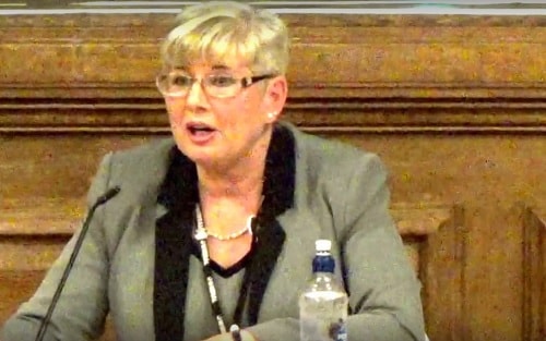
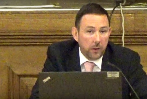
How was the planning application for a fire station at Saughall Massie (APP/16/00985) introduced to Wirral Council’s Planning Committee (part 1)?
How was the planning application for a fire station at Saughall Massie (APP/16/00985) introduced to Wirral Council’s Planning Committee (part 1)?
Please accept YouTube cookies to play this video. By accepting you will be accessing content from YouTube, a service provided by an external third party.
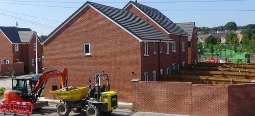
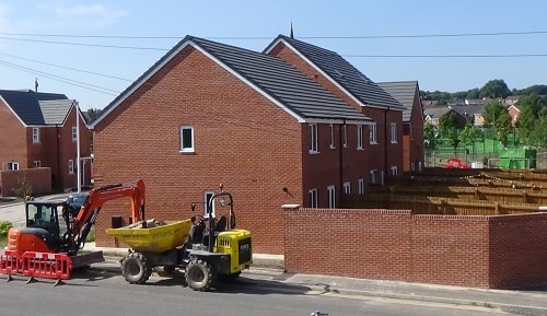
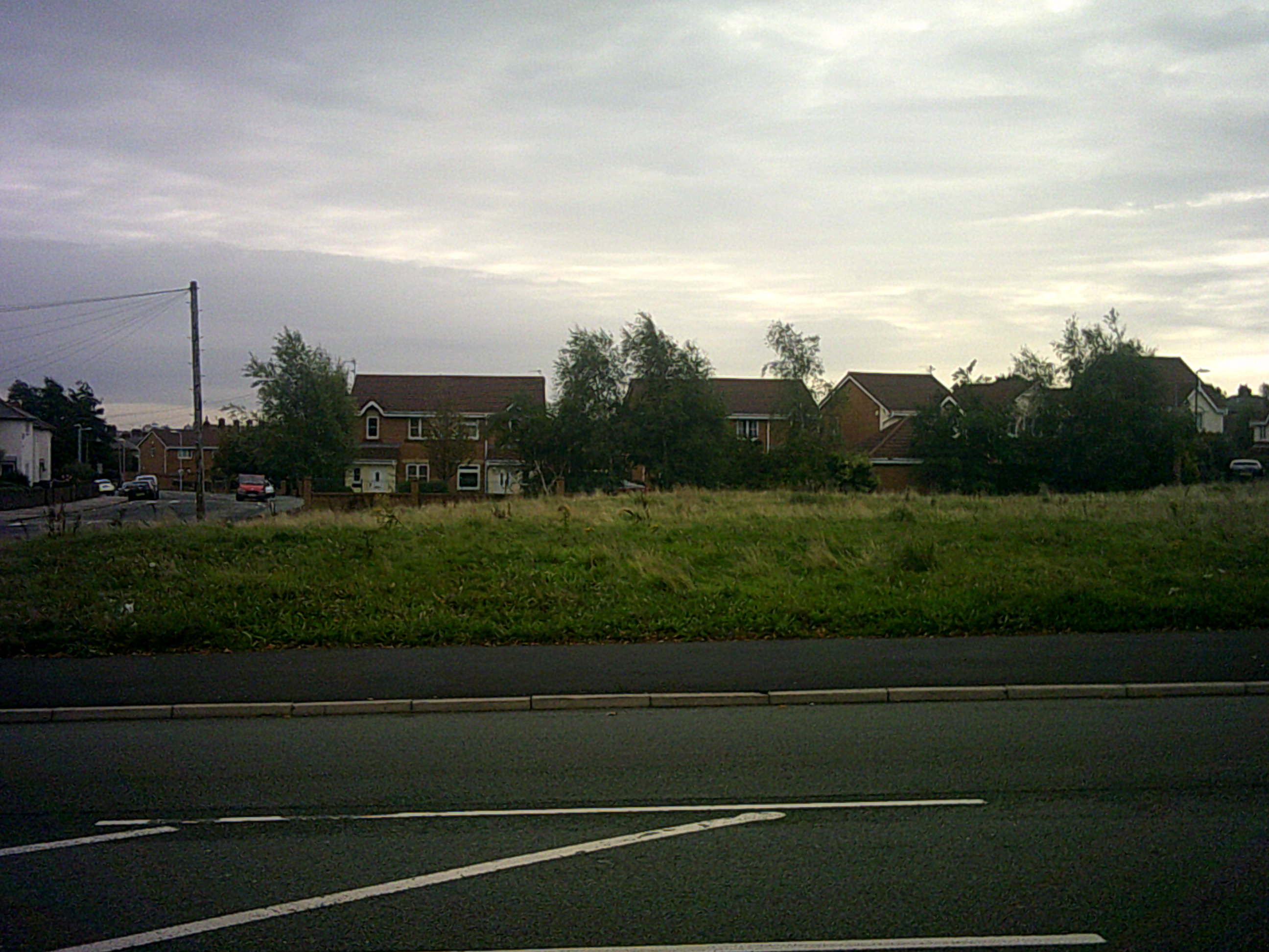
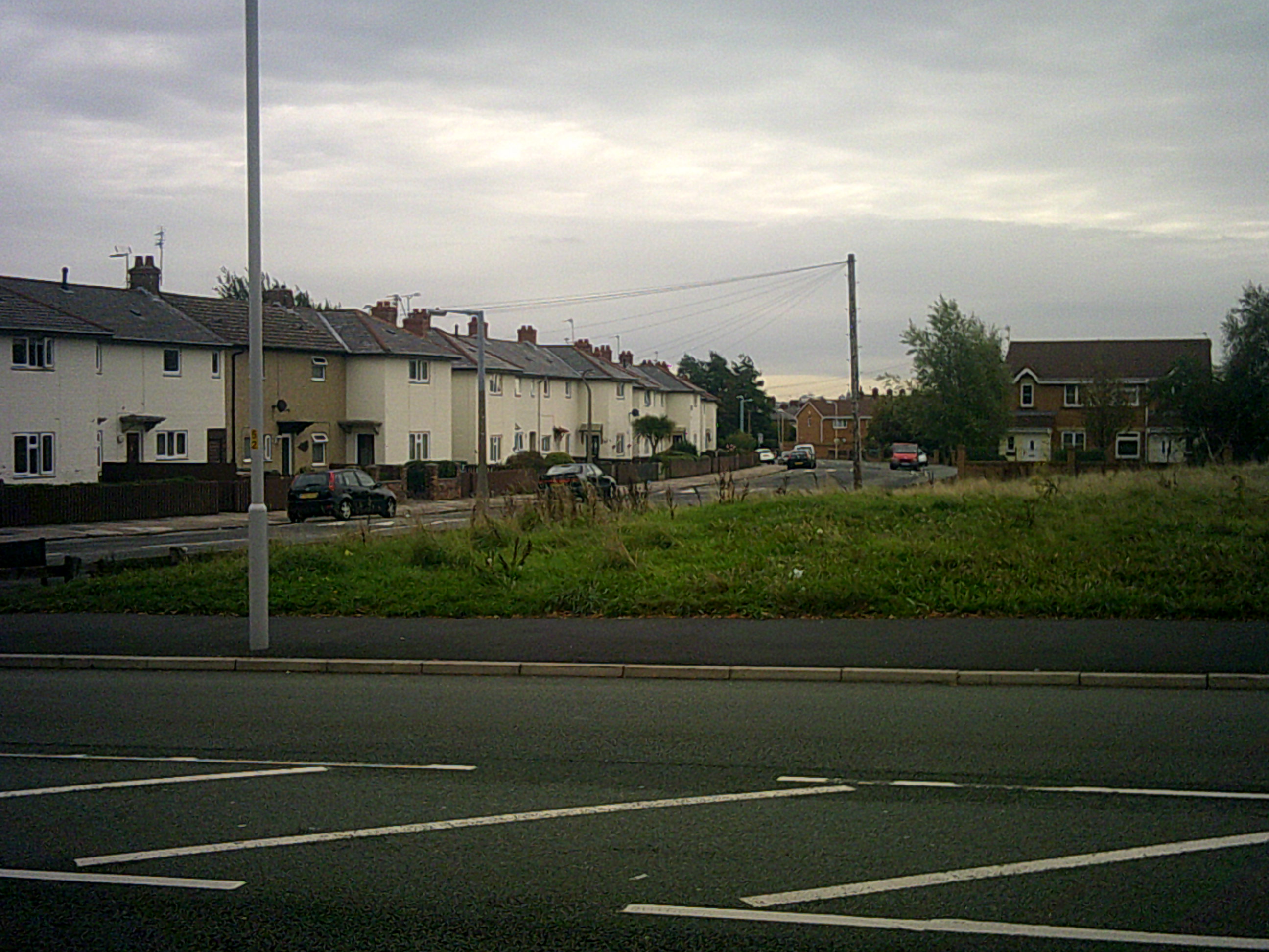
Over a hundred people were in the Civic Hall for a public meeting of Wirral Council’s Planning Committee held last week at Wallasey Town Hall to hear what the Planning Committee would decide on planning application APP/16/00985. This planning application was for a single storey two bay community fire station with accommodation, offices, meeting space, external drill, training facilities and car parking on land adjacent to Saughall Massie Road in Saughall Massie.
The applicant was Merseyside Fire & Rescue Service.
Matthew Parry-Davies (Service Manager (Development Management), Wirral Council) Planning Committee 15th December 2016 planning application APP/16/00985
Planning permission was sought for a single storey two bay community fire station, together with operational and welfare accommodation, offices and meeting space, external drill and training facilities and associated car parking.
Continuing, he said that the site was in the green belt and as such the development applied for constituted, “inappropriate development”. Having regard to national planning policies and Wirral’s Unitary Development Plan and policy GB2 which set out guidelines for development in the green belt, such inappropriate development should be refused unless “very special circumstances” had been put forward that would outweigh any potential harm to the openness and character of the green belt.
Mr Parry-Davies explained that there were not a national or local definitions of what constituted “very special circumstances” and as such each [planning] application needed to be judged on its individual merits.
Referring to the applicant’s case, he stated that the need for a new fire station in this greenbelt location centred on the unavailability of suitable alternative locations outside of the green belt and the need to provide the best achievable emergency response to west Wirral locations.
Mr Parry-Davies said that Merseyside Fire and Rescue Authority were rationalising their property portfolio of operational fire stations arising from cost efficiencies which resulted in the closure of fire stations. As a result of this either West Kirby Fire Station or Upton Fire Station would have to close as a result of budget cuts, with Upton Fire Station remaining crewed because it covered a more extensive area.
It was the applicant’s case that the provision of a new fire station in this location to cover both the West Kirby and Upton coverage areas, would result in a reduction of response times to west Wirral by an average of two minutes.
He mentioned a link between response times and the level of damage to property, severity of injury and the likelihood of death. The quicker the Merseyside Fire and Rescue Service could respond, the less likely major damage, significant injury or fatalities would occur. Closing West Kirby Fire Station and Upton Fire Station and building a new fire station at this location, would result in faster than average response times which could mean the difference between the level of damage and/or the severity of injury or even death.
Mr Parry-Davies said that the new location would allow Merseyside Fire and Rescue Service to maintain acceptable response times and it was argued that this demonstrates very special circumstances that outweighed the potential harm to the greenbelt.
Commenting on the site, he said that the site was opposite residential properties on Saughall Massie Road to the north and Woodpecker Close to the east. The nearest residential properties were 281 Saughall Massie Road and numbers 68, 70 and 72 Woodpecker Close. Mr Parry-Davies wanted to spend a little time explaining the relationship between the proposal to the residential properties and he was putting a different plan up for councillors to see.
Referring to the appliance bay, he explained that the appliance bay was the part of the fire station where the fire engines would be housed. The operational bay was the other side of the proposal where the meeting rooms, sleeping accommodation, kitchens and those sorts of things would be.
So firstly, the properties that front on to Saughall Massie Road which were 286 to 296 Saughall Massie Road. These were thirty metres to forty metres from the site perimeter. 296 Saughall Massie Road was located fifty-five metres from the front of the operational and welfare part of the proposals and fifty-nine metres from the appliances bay which would house the fire engines.
These distances decreased slightly with 288 being fifty metres from the operational bay and fifty-seven metres from the appliances bay before increasing again as you move east along Saughall Massie Road.
The blank elevation of 281 Saughall Massie Road which was a bungalow was located thirteen metres at its closest point to the perimeter of the site and thirty metres to the operational bay. The appliances bay would be forty-five metres from that property but sits behind the operational bay.
Numbers 68, 70 and 72 Woodpecker Close would have their front elevations facing the site and they were bungalows. These properties were sheltered accommodation for elderly people. At its nearest point 68 Woodpecker Close is fourteen metres from the site boundary, number 70 is fifteen and a half metres and number 72 is seventeen metres from the boundary.
Number 68 Woodpecker Close is thirty-two metres from the operational bay, number 70 is thirty-four metres and number 72 is thirty-five metres away. The operational bay sits between those properties and the appliance bay, acting as a buffer for the appliance bay where the fire engines would be housed.
A sprinkler and generator compound, the area edged red on the plan is located in the southeast corner of the site, located twenty-five metres from the rear elevations of 47-51 Woodpecker Close. These properties were located over forty metres from any part of the proposed buildings.
The training yard was the yellow hatched area of the plan which would be located to the rear of the bays and would be over fifty metres from the nearest residential property. He pointed out a retractable training tower located at the southern part of the site. Training would typically be carried out at monthly intervals, during the working day without the use of sirens. The training tower would fold down when not in use to minimise its impact on the green belt.
A noise assessment had been submitted with the application, which had examined noise sensitive receptors including residential properties. Measures were proposed to minimise noise impact, although the fire station would be operational twenty-four hours a day, the yard would only be used when returning from an incident between the hours of 11 pm and 7 am and would only be used for operational and training purposes between 9 30 in the morning and 4 30 in the afternoon. Sirens would only be used at times when there was significant road traffic and at night restricted to calls where life was at risk. A number of conditions were proposed should the application be approved, to avoid and or minimise noise impacts.
In terms of highway movements and the impact on the safe use and flow of the highway, the development is likely to generate low levels of vehicle movements onto the adjacent network and are therefore unlikely to have significant impact on traffic conditions in the area.
The Saughall Massie Conservation Area boundary site thirty-five metres to the north-west. However given the use of materials proposed, existing vegetation providing screening and distances involved, it was not considered the proposals would adversely impact on the Saughall Massie Conservation Area.
Substantial weight must be given to any harm these proposals would have on the green belt by virtue of the permanent loss of openness and any visual harm that may result. Councillors on the Planning Committee must be satisfied that very special circumstances exist that outweighs any harm caused by inappropriate development. The reduced response times enabling Merseyside Fire and Rescue Service to attend emergencies in parts of west Wirral would be two minutes quicker on average and has led to a finely balanced recommendation of approval.
A number of measures proposed in terms of site layout, boundary treatment, together with planning conditions outlined in the report, serve to mitigate against any harm to residential amenity. On balance the application was recommended for approval and there was a qualifying petition of objection.
The Chair Cllr Anita Leech thanked Mr Parry-Davies for his presentation. As there was a qualifying petition of objection she asked if the lead petitioner would like to come forward?
Cllr Steve Williams (Moreton West and Saughall Massie) explained that the lead petitioner did not wish to speak.
The Chair thanked him for that and explained that as the lead petitioner hadn’t spoken, then the applicant wasn’t able to speak according to the constitution.
She asked if the ward councillor would like to come forward and speak and asked him to give his name before he started.
If you click on any of the buttons below, you’ll be doing me a favour by sharing this article with other people.
Public meetings for Wirral Council, Liverpool City Region Combined Authority & a meeting on Chief Officer’s pay
Public meetings for Wirral Council, Liverpool City Region Combined Authority & a meeting on Chief Officer’s pay
Left to right newly elected Mayor of Wirral Councillor Steve Foulkes and former Mayor of Wirral Councillor Dave Mitchell at the Annual Meeting of Wirral Borough Council on 2nd June 2014
Below is a list of upcoming public meetings & other matters involving local government happening this week. Most are local, but the House of Common’s Communities and Local Government Select Committee on Chief Officer’s pay in local government should be available to watch live on Parliament’s website.
=======================================================================================================
Date: Monday 9th June 2014
Time: 4.15pm
Public Body/Committee: House of Commons
Venue: The Thatcher Room, Portcullis House
Type of meeting: Communities and Local Government Select Committee
Subject: Operation of the National Planning Policy Framework
Witnesses – Richard Blyth (Royal Town Planning Institute),
David Henry (Royal Institution of Chartered Surveyors),
Councillor Tony Newman (Local Government Association),
Councillor Gillian Brown (District Councils’ Network),
Mike Kiely (President of the Planning Officers Society) and
Councillor Ken Browse, (Chairman, National Association of Local Councils)
=======================================================================================================
Date: Monday 9th June 2014
Time: 6.15pm
Public Body/Committee: Wirral Council
Venue: Council Chamber, Wallasey Town Hall, Brighton Street, Wallasey, CH44 8ED
Type of meeting: Annual Meeting of the Council Part 2
This continues from the Annual Meeting of the Council part 1 which was adjourned the previous week.
The agenda is items 6-12 and the reports pack and supplementary can be downloaded from Wirral Council’s website.
6. Declarations of Interest
7. Civic Mayor’s Announcements
8. Petitions
9. Minutes (10th March 2014)
10. Election Results – 22 May 2014
11. Leader’s Announcement
12. Matters Requiring Approval by Council
=======================================================================================================
Date: Wednesday 11th June 2014
Time: 4.15pm
Public Body/Committee: House of Commons
Venue: Room 5, Palace of Westminster
Type of meeting: Communities and Local Government Select Committee
Subject: Local Government Chief Officer’s remuneration
Witnesses – Councillor Colin Lambert (Former Leader, Rochdale Borough Council),
Jim Taylor (Former Chief Executive, Rochdale Borough Council),
Councillor David Hodge (Leader, Surrey County Council),
David McNulty (Chief Executive, Surrey County Council),
Mary Pett (Honorary Secretary of the Association of Local Authority Chief Executives),
Mark Rogers (Solace President and Chief Executive of Birmingham City Council) and
Mike Short, Senior National Officer for Local Government, UNISON
=======================================================================================================
On Friday 13th June there is the second meeting of the Liverpool City Region Combined Authority. In what must seem like the film Groundhog Day, once again Councillor Phil Davies will face an election if he wishes to continue as Chair.
The agenda and reports for the meeting can be downloaded from Knowsley Borough Council’s website.
Date: Friday 13th June 2014
Time: 11.00am
Public Body/Committee: Liverpool City Region Combined Authority
Venue: Authority Chamber – No. 1 Mann Island, Liverpool, L3 1BP
Type of meeting: Annual Meeting
1. Appointment of Chair and Vice Chair
2. Apologies
3. Declarations of Interest
4. Liverpool City Region Combined Authority Constitution
5. Scrutiny Arrangements pdf icon PDF 342 KB
6. Combined Authority Nominations and Appointments
7. Liverpool City Region Combined Authority Forward Plan
8. Apologies
9. Declarations of Interest
10. Minutes of Combined Authority Meeting on 1 April 2014
11. Liverpool City Region Growth Plan and Local Growth Fund Submission
12. Freight and Logistics in the Liverpool City Region
13. SciTech Daresbury – Alan Turing Institute
14. EU Governance Arrangements 2014-2020
15. Liverpool City Region: Draft Long Term Rail Strategy
16. High Speed 2 Action Plan
17. Rail Devolution Update
18. Youth Unemployment in the Liverpool City Region
19. Liverpool City Region Strategic Local Investment Plan (2014-17) Housing Sites
20. Response to Consultation on Legislation Relating to Combined Authorities and Economic Prosperity Boards
21. Minutes
21a Merseytravel Committee – 10 April 2014
21b Merseytravel Committee – 29 May 2014
21c Merseytravel Committee – 4 June 2014
22. Any Other Item(s) which the Chair Deems to be Urgent
If you click on any of the buttons below, you’ll be doing me a favour by sharing this with other people.
Wirral Council’s Planning Committee agrees to outline planning application for four bungalows on the Paddock, Kinloss Road, Greasby (OUT/13/00826) (31st October 2013)
Please accept YouTube cookies to play this video. By accepting you will be accessing content from YouTube, a service provided by an external third party.
If you accept this notice, your choice will be saved and the page will refresh.
Please accept YouTube cookies to play this video. By accepting you will be accessing content from YouTube, a service provided by an external third party.
If you accept this notice, your choice will be saved and the page will refresh.
The first planning application starts at 5:15 in the first video above.
Wirral Council’s Planning Committee agrees to outline planning application for four bungalows on the Paddock, Kinloss Road, Greasby (OUT/13/00826) (31st October 2013)
The Chair, Cllr Bernie Mooney asked an officer to introduce the planning application. He explained what it was for, why the officers had recommended it for approval and the officer’s response to the objections raised (which were mainly highway safety issues). He said that although it had a value as an open space, it was not designated as a green space or open to the public.
The lead petitioner introduced herself as Helen O’Donnell and explained why a hundred and forty-nine people had signed a petition objecting to the planning application. The first area of concern was safe access into and out of the housing estate, the petitioners felt that leaving this land open had been integral to the design of the original RAF estate. The petitioners felt that building here would lead to a loss of sight lines and a reduction in highway safety. Concerns were also raised about what would happen to the laybys which the petitioners felt were needed for a free flow of traffic. Helen O’Donnell also wanted the green rural route protected by the Planning Committee not approving the planning application.
The applicant, who introduced herself as Mrs. Glynn said that she hadn’t seen the photos circulated by Helen O’Donnell. She pointed out that the planning officers had recommended it for approval and that the proposed buildings were single storey and of a low density. She felt that everything had been done to meet the objector’s needs and repeated that it was recommended for approval by the planning department.
Cllr Steve Foulkes said he would like to hear from councillors who had been on the site visit. The Chair said that she had been on the site visit and that she couldn’t see what difference four households would make to access. Cllr Wendy Clements asked where the dwellings would be and asked for a response from the officers about the speed of traffic.
Matthew Rushton referred to an extra condition on the late list and that the greenery on the other side of the roundabout was maintained as public open space. An officer responded on highways safety grounds that there had been no accidents there over the last five years.
Cllr Eddie Boult said that he couldn’t see a problem with traffic on the site visit and that he found the photo circulated by the petitioners misleading as it was of a different area.
Cllr Geoffrey Watt said that he had also been on the site visit. Although he would be sad to see the loss of openness, there were still some green spaces left and he couldn’t think of a good planning reason for rejecting the planning application. He asked if a condition could be added to restrict the buildings to a single storey?
Cllr David Elderton pointed out that the photos weren’t of the site and that the police enforced the speed limit on this stretch of road, he agreed with Cllr Watt that it was nice to see urban green space, but again he couldn’t see any reasons for objecting to it.
Cllr Stuart Kelly agreed with what was said about traffic and pointed out that in the report it stated that it wasn’t designated as urban green space, however in the open space assessment it had been designated as open space (although officers had advised him this was in error). He referred to paragraphs seventy-four and seventy-seven of the National Planning Policy Framework and policy HS4. Cllr Kelly didn’t feel there were grounds to refuse it on highway safety grounds. He referred to a covenant on the land stating it was for grazing purposes.
The Chair thanked Cllr Kelly for his contribution. Cllr Foulkes said that when he had first joined the Council [in 1990], he had been on the Unitary Development Plan Working Party, but nobody had lobbied them then to make this land green space. He recognised that local people believed it was green space, but that the developer had set aside part of the land as an amenity space, he said he would struggle to support refusal if Cllr Kelly moved it. He felt that the extra car movements from four bungalows was insignificant and that he welcomed the comments from people who’d been on the site visit and pointed out that the photo was of somewhere else.
Matthew Davies said that it was designated in the Unitary Development Plan as a primary residential area. He referred to the criteria for a green space designation under the National Planning Policy Framework and said it couldn’t be described as beautiful and that it didn’t have historic or recreational value. If the planning application was refused on these grounds he thought that they would struggle to defend the decision at appeal.
Cllr Wendy Clements said she had looked at the map online and it was designated as urban green space.
Matthew Davies said that they had had a piece of work undertaken as part of the core strategy as to where the open spaces were. The consultant had picked this site, whereas Wirral Council had meant the consultant instead to include the site maintained by the parks and recreation department on the other side of the roundabout.
Cllr Watt asked again about a condition limiting the bungalows to a single storey. Matthew Davies replied that there could be a condition added restricted it to a single storey.
Cllr Denise Realey proposed approval (with the extra condition), Cllr Irene Williams seconded this. Eight councillors voted in favour. Three (Cllr Stuart Kelly, Cllr Geoffrey Watt and Cllr Paul Hayes) voted against. One councillor abstained, so the application was approved.
If you click on any of these buttons below, you’ll be doing me a favour by sharing this article with other people. Thanks:
Tollemache Road greenspace or 12 houses? Planning Committee decides tonight
Tollemache Road greenfield or 12 houses? Planning Committee decides tonight
You can click on the photos above for more detailed versions. Earlier this year in a similar case, despite Cllr Ian Lewis’s best efforts, the Planning Committee voted 7 votes to 6 against local resident’s wishes to approve building a play area on some greenspace in Leasowe.
This planning application is for building a dozen houses on this field. The officer’s report to the Planning Committee recommends refusal as they believe it to conflict with policies HS4, GR6, CS42, CS6, CS32 and the National Planning Policy Framework. Normally such an application would be decided by officers. However Cllr George Davies (the Cabinet Member for Neighbourhoods, Housing and Engagement) has taken it out of their hands and asked for the Planning Committee to decide it instead as Cllr George Davies thinks that the proposed development would “help to address identified housing needs”.
This is unusual in itself as generally this is only done by councillors representing the ward the planning application which in this case is Bidston & St. James ward. Cllr George Davies represents the adjoining Claughton ward. A number of local residents in Bidston and St. James ward have objected to the planning application.
The demand for two-bedroom rental properties in the area is because of the “bedroom tax”*/spare room subsidy* (*choose which term you prefer depending on your politics). Although it may go some way to meet this need if approved, building houses there is unpopular with local residents who want the greenspace to stay for the many reasons outlined in the officer’s report.
If you click on any of these buttons below, you’ll be doing me a favour by sharing this article with other people. Thanks: